Digger_O'Dell
New member
Re: 1785 coin discussion, cellar hole continuation
Instead of clogging up a post of a great coin find, I thought I would start a new thread discussing my cellar hole dilemma. The last reply was by Dell:
"take pictures next time your there or anywhere really you think some very old areas are or suppose to be , we might be able to spot something that is a bit subtle to what your use to"
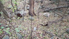
As it's currently an hour drive away, it's not practical to head out to snap a few photos, but I do have a few pics from the last time I was there. The first photos are of the cellar hole itself. It's mostly filled in but you nan still see the outline of the walls. The second photo is a drawing showing the wall outline.


This is a close-up of the pot discarded inside the hole

The next photo is of the stone lined well. Someone put some fence around it since it looks like people have been hiking along the edge of the field bordering the well, probably so nobody falls in.

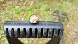
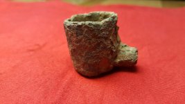
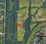
The rest of the photos are items found at nearby fields. Maybe related, maybe not. First is a musket ball, which was found near the well. The bells and hoe were found several fields over. about 1/2 mile away. The real interesting find was a pewter pipe bowl, found in another nearby field about 1/4 mile away.


Instead of clogging up a post of a great coin find, I thought I would start a new thread discussing my cellar hole dilemma. The last reply was by Dell:
"take pictures next time your there or anywhere really you think some very old areas are or suppose to be , we might be able to spot something that is a bit subtle to what your use to"
As it's currently an hour drive away, it's not practical to head out to snap a few photos, but I do have a few pics from the last time I was there. The first photos are of the cellar hole itself. It's mostly filled in but you nan still see the outline of the walls. The second photo is a drawing showing the wall outline.


This is a close-up of the pot discarded inside the hole

The next photo is of the stone lined well. Someone put some fence around it since it looks like people have been hiking along the edge of the field bordering the well, probably so nobody falls in.

The rest of the photos are items found at nearby fields. Maybe related, maybe not. First is a musket ball, which was found near the well. The bells and hoe were found several fields over. about 1/2 mile away. The real interesting find was a pewter pipe bowl, found in another nearby field about 1/4 mile away.


